Wiki-balade de Saint-Martin : Différence entre versions
(ajout mp3) |
|||
| Ligne 21 : | Ligne 21 : | ||
| Kerigonan || <mp3>http://www.wiki-brest.net/images/9/9a/0008-Kerigonan.mp3|download</mp3> | | Kerigonan || <mp3>http://www.wiki-brest.net/images/9/9a/0008-Kerigonan.mp3|download</mp3> | ||
|- | |- | ||
| − | | Rue Danton | + | | Rue Danton || <mp3>http://www.wiki-brest.net/images/c/c4/0010-Rue_danton.mp3|download</mp3> |
|- | |- | ||
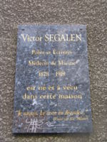
| − | | Maison de Victor Segalen|| <mp3>http://www.wiki-brest.net/images/ | + | | Maison de Victor Segalen|| <mp3>http://www.wiki-brest.net/images/6/64/0011-Victor-Segalen.mp3|download</mp3> |
|- | |- | ||
| − | | Place Guérin || <mp3>http://www.wiki-brest.net/images/4/44/Kags-7-portde.mp3|download</mp3> | + | | Place Guérin **|| <mp3>http://www.wiki-brest.net/images/4/44/Kags-7-portde.mp3|download</mp3> |
|- | |- | ||
| Ecole || <mp3>http://www.wiki-brest.net/images/c/cb/Kags-5-porte.mp3|download</mp3> | | Ecole || <mp3>http://www.wiki-brest.net/images/c/cb/Kags-5-porte.mp3|download</mp3> | ||
| Ligne 35 : | Ligne 35 : | ||
== La carte interactive pour visualiser la balade== | == La carte interactive pour visualiser la balade== | ||
| − | <googlemap lat="48. | + | <googlemap lat="48.396286" lon="-4.481606" type="satellite" zoom="17" width="600" height="600"> |
48.394921, -4.481521, Lavoir | 48.394921, -4.481521, Lavoir | ||
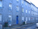
48.395644, -4.482599, Immeubles écailles en zinc | 48.395644, -4.482599, Immeubles écailles en zinc | ||
| − | /Info\'''Immeubles anciens'''<BR />Ces immeubles de la rue Malakoff sont recouverts d'écailles de zinc | + | /Info\ '''Immeubles anciens'''<BR />Ces immeubles de la rue Malakoff sont recouverts d'écailles de zinc |
| − | /Photos\[[Image:St-martin immeuble-rue-malakoff.jpg|none|thumb|150px]] | + | /Photos\ [[Image:St-martin immeuble-rue-malakoff.jpg|none|thumb|150px]] |
48.397404, -4.484396, Place Nicolas Appert | 48.397404, -4.484396, Place Nicolas Appert | ||
| − | /Info\'''Place Nicolas Appert''' | + | /Info\ '''Place Nicolas Appert''' |
| − | /Photos\[[Image:St-martin place-nicolas-appert.jpg|none|thumb|300px]] | + | /Photos\ [[Image:St-martin place-nicolas-appert.jpg|none|thumb|300px]] |
48.397778, -4.483479, Logements Kerigonan | 48.397778, -4.483479, Logements Kerigonan | ||
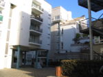
| − | /Info\'''Logements de Kerigonan''' | + | /Info\ '''Logements de Kerigonan''' |
| − | /Photos\[[Image:St-martin immeuble-kerigonan.jpg|left|thumb|150px]][[Image:St-martin immeuble-kerigonan1.jpg|left|thumb|150px]][[Image:St-martin immeuble-kerigonan-jardins | + | /Photos\ [[Image:St-martin immeuble-kerigonan.jpg|left|thumb|150px]][[Image:St-martin immeuble-kerigonan1.jpg|left|thumb|150px]][[Image:St-martin immeuble-kerigonan-jardins.jpg|none|thumb|150px]] |
| − | |||
| − | |||
| − | |||
48.395758, -4.479718, Hôtel des associations, Immeuble Proudhon | 48.395758, -4.479718, Hôtel des associations, Immeuble Proudhon | ||
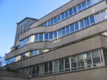
| − | /Info\'''Immeuble Proudhon''' | + | /Info\ '''Immeuble Proudhon''' |
| − | /Photos\[[Image:St-martin proudhon.jpg|left|thumb|150px]] | + | /Photos\ [[Image:St-martin proudhon.jpg|left|thumb|150px]] |
48.396763, -4.479579, Place Guérin | 48.396763, -4.479579, Place Guérin | ||
| − | /Info\'''Place Guérin''' | + | /Info\ '''Place Guérin''' |
| − | /Photos\[[Image:St-martin place guerin.jpg|left|thumb|150px]][[Image:St-martin place guerin1.jpg|none|thumb|150px]] | + | /Photos\ [[Image:St-martin place guerin.jpg|left|thumb|150px]][[Image:St-martin place guerin1.jpg|none|thumb|150px]] |
48.396357, -4.479053, Ecole | 48.396357, -4.479053, Ecole | ||
| − | /Info\'''Ecole de St-Martin''' | + | /Info\ '''Ecole de St-Martin''' |
| − | /Photos\[[Image:St-martin ecole.jpg|none|thumb|150px]] | + | /Photos\ [[Image:St-martin ecole.jpg|none|thumb|150px]] |
| − | 48. | + | 48.396806, -4.481295, Maison Victor Ségalen |
| − | /Info\'''Maison Victor Ségalen''' | + | /Info\ '''Maison Victor Ségalen''' |
| − | /Photos\[[Image:Plaque-victor-segalen.jpg|none|thumb|150px]] | + | /Photos\ [[Image:Plaque-victor-segalen.jpg|none|thumb|150px]] |
| − | # | + | 48.396506, -4.48188, Bar près des halles st-martin |
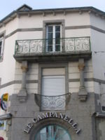
| + | /Info\ '''Bar "Le Campanella" près des halles St-Martin''' | ||
| + | /Photos\ [[Image:St-martin campanella.jpg|none|thumb|150px]] | ||
| + | #1450ED | ||
48.395096, -4.480212, Eglise | 48.395096, -4.480212, Eglise | ||
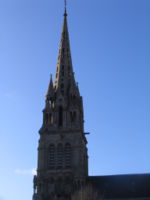
| − | /Info\'''Eglise de Saint-Martin''' | + | /Info\ '''Eglise de Saint-Martin''' |
| − | /Photos\[[Image:St-martin eglise.jpg|none|thumb|150px]] | + | /Photos\ [[Image:St-martin eglise.jpg|none|thumb|150px]] |
48.39501, -4.480083 | 48.39501, -4.480083 | ||
48.394832, -4.480362 | 48.394832, -4.480362 | ||
| Ligne 81 : | Ligne 81 : | ||
48.397696, -4.482894 | 48.397696, -4.482894 | ||
48.396549, -4.481767 | 48.396549, -4.481767 | ||
| − | 48. | + | 48.397205, -4.480898 |
| − | 48. | + | 48.396043, -4.479053 |
| − | + | 48.395666, -4.479632 | |
| − | |||
| − | 48. | ||
| − | |||
</googlemap> | </googlemap> | ||
[[catégorie:Wiki-balade]] | [[catégorie:Wiki-balade]] | ||
Version du 4 décembre 2007 à 15:16
Visite du quartier par un groupe d'habitants
Un groupe d'une trentaine d'habitants, accompagnés par Elodie CORNEC (Agent de développement - Développement Social Urbain de la Ville de Brest) et par Christine BERTHOU-BALLOT (Archiviste de la Ville de Brest), a parcouru les rues de Saint-Martin le samedi 1er décembre 2007.
Le circuit commence devant de l'église et se termine à l'hôtel des associations Prudhon.
| Introduction | download</mp3> |
| L'église | download</mp3> |
| Le lavoir | download</mp3> |
| Le lavoir transformé en jardin | download</mp3> |
| Les immeubles de la rue Malakoff | download</mp3> |
| Quartier Place Nicolas Appert | download</mp3> |
| Kerigonan | download</mp3> |
| Rue Danton | download</mp3> |
| Maison de Victor Segalen | download</mp3> |
| Place Guérin ** | download</mp3> |
| Ecole | download</mp3> |
| Immeuble Proudhom | download</mp3> |
Télécharger la balade complète au format MP3 ou au format OGG (clic droit et enregistrer la cible sous...)
La carte interactive pour visualiser la balade
<googlemap lat="48.396286" lon="-4.481606" type="satellite" zoom="17" width="600" height="600">
48.394921, -4.481521, Lavoir
48.395644, -4.482599, Immeubles écailles en zinc
/Info\ Immeubles anciens
Ces immeubles de la rue Malakoff sont recouverts d'écailles de zinc
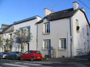
48.397404, -4.484396, Place Nicolas Appert /Info\ Place Nicolas Appert
/Photos\48.397778, -4.483479, Logements Kerigonan /Info\ Logements de Kerigonan
/Photos\48.395758, -4.479718, Hôtel des associations, Immeuble Proudhon /Info\ Immeuble Proudhon
/Photos\48.396763, -4.479579, Place Guérin /Info\ Place Guérin
/Photos\48.396357, -4.479053, Ecole /Info\ Ecole de St-Martin
/Photos\48.396806, -4.481295, Maison Victor Ségalen /Info\ Maison Victor Ségalen
/Photos\48.396506, -4.48188, Bar près des halles st-martin /Info\ Bar "Le Campanella" près des halles St-Martin
/Photos\- 1450ED
48.395096, -4.480212, Eglise /Info\ Eglise de Saint-Martin
/Photos\48.39501, -4.480083 48.394832, -4.480362 48.395388, -4.481285 48.394961, -4.481574 48.395381, -4.481478 48.395709, -4.482486 48.396236, -4.484171 48.39719, -4.484332 48.397497, -4.484192 48.397717, -4.484042 48.397967, -4.483709 48.397874, -4.483387 48.397725, -4.483473 48.397454, -4.483184 48.397696, -4.482894 48.396549, -4.481767 48.397205, -4.480898 48.396043, -4.479053 48.395666, -4.479632 </googlemap>


